Julio Pastrana and Tim Wigbels are awarded 1st place at the Bonner Ideenbörse for their innovative ideas on laser-based weeding.
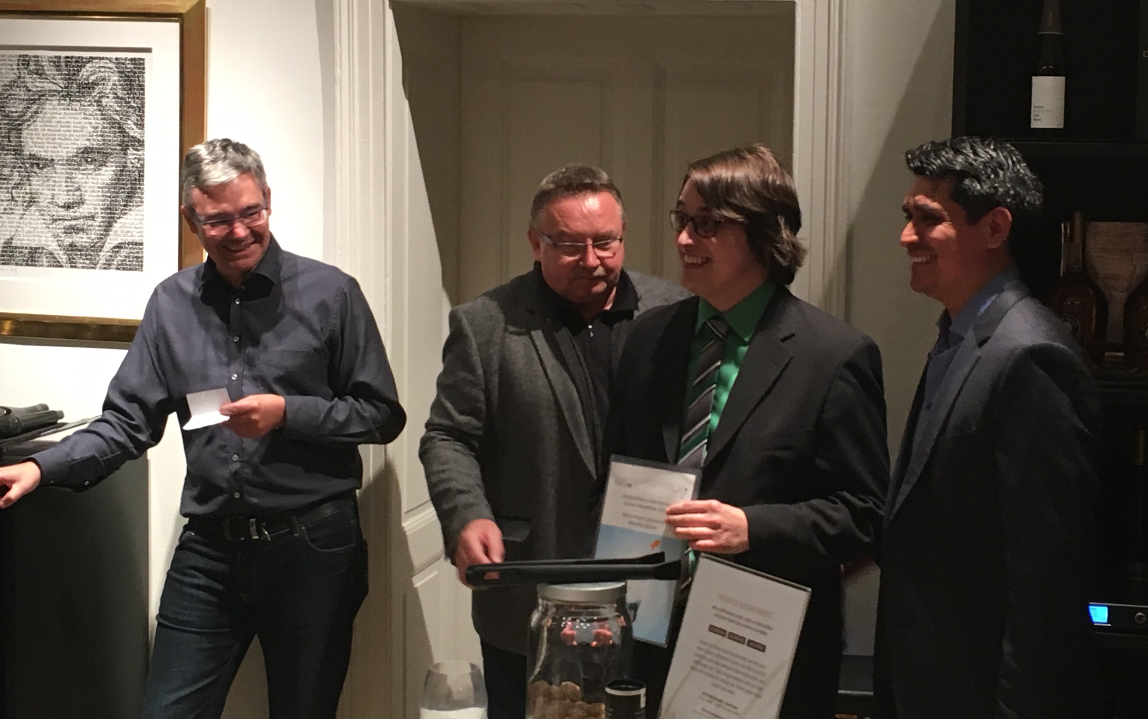
Julio Pastrana and Tim Wigbels are awarded 1st place at the Bonner Ideenbörse for their innovative ideas on laser-based weeding.
Cyrill Stachniss and Heiner Kuhlmann submitted together with several principal investigators and collaborators from the University of Bonn and the Research Center Jülich a Cluster of Excellence draft proposal to the DFG called “PhenoRob – Robotics and Phenotyping for Sustainable Crop Production”. More details can be found at http://www.phenorob.de.
EXIST-Funded startup focussing on an autonomous laser-based weeding system has started in Feb 2017 at the Photogrammetry & Robotics Lab.
Abstract – For decades, herbicides have been the main means of weed control. The extensive use of chemical substances in agriculture is generating devastating effects on our environment and is also affecting human health. Additionally, several weed varieties have been developing a natural resistance to the applied chemicals, hence new and more potent herbicides have to be developed.
Due to the great ecological and human health effects, the world is demanding chemical free crops from our fields. Laser-based weeding is an excellent non-herbicide solution to weed control that will enable the production of organic certified products.
The proposed system uses multi-spectral sensors and state of the art computer vision algorithms to detect and classify all plants on the field. After identifying the weed plants, a laser beam will be used to eliminate or to seriously damage the weeds. In this way, value crops can grow without the competition from weed and have higher yields because all available nutrients do not have to be shared.
This technology has the potential for installing a new generation of sustainable crop production farms. With the use of the laser-based weeding system at large scales, herbicide use can be substantially reduced. Our goal is that within the foreseeable future this weeding method will be used by every major crop producer, thus, protecting the the environment and the health of the population.
Contact:
Julio Pastrana (julio.pastrana@nullescarda.net) and Tim Wigbels (tim.wigbels@nullescarda.net)
The kickoff meeting of the EUROPA project on urban robot navigation was held in Feb 2009 in Freiburg and on Jan 20, 2017, the final review of the successor project EUROPA2 ended with an excellent evaluation. A big thank you to all our partners and team members from the University of Freiburg and Oxford, KU Leuven, ETH Zürich, RWTH Aachen as well as GeoAutomation and BlueBotics.
Demo of the sugar beets and weed classification system at a test fields of the ETH Crop Science lab in Eschikon.
For more details on the approach see: P. Lottes, M. Hoeferlin, S. Sanders, and C. Stachniss: “Effective Vision-Based Classification for Separating Sugar Beets and Weeds for Precision Farming”, Journal of Field Robotics, 2016 on our publication page.
The EC-funded project ROVINA has the goal of providing new means for accessing and digitizing cultural heritage sites. It is targeted at developing innovative digital preservation tools and at the same time novel technologies that strengthen the robustness of robots operating in previously unknown and unstructured 3D environments. On September 26, 2016 the final review of the 42 month project was successful so that ROVINA has been evaluated excellently in all four review meetings.
The collaborative project has been conducted by a consortium coordinated by Cyrill Stachniss at the University of Bonn that includes experts from robotics, computer vision and archeology: KU Leuven, La Sapienza University of Rome, RWTH Aachen, University of Freiburg, Algorithmica and the International Council of Monuments and Sites.
[huge_it_gallery id=”2″]
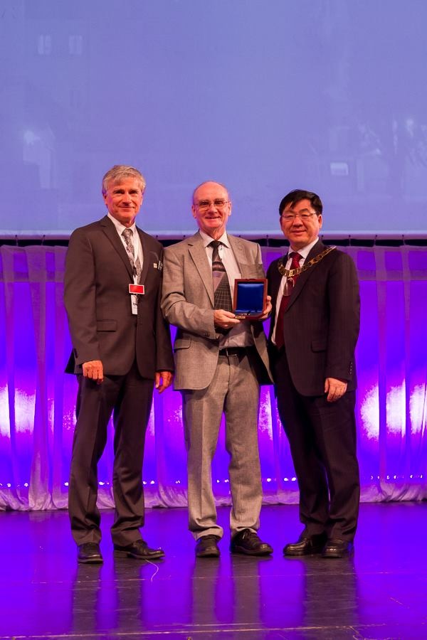
The International Society for Photogrammetry and Remote Sensing (ISPRS) announced today that Prof. Wolfgang Förstner of Bonn University, Germany, will be presented with the 2016 Brock Gold Medal Award for his outstanding scientific achievements in the fields of photogrammetry and computer vision.
Professor Förstner is an internationally leading expert in photogrammetry, computer vision, pattern recognition and machine learning. Throughout his exemplary career of nearly 40 years as a researcher, inventor, innovator and educator, he has made exceptionally significant scientific contributions
in many areas of Information from Imagery and mentored generations of mapping scientists and engineers. Examples of his work include blunder detection for aerial triangulation, image matching, object recognition and statistical projective geometry. The well known Förstner Operator, for the detection of key points in images, was developed by him in the 1980’s. After studying Geodesy and Surveying, Förstner first worked at the University of Stuttgart before moving to the University of Bonn as Professor for Photogrammetry from 1990 until his retirement in 2012. Although now formally retired, he continues his scientific activities.
The Brock Gold Medal is sponsored by the American Society for Photogrammetry and Remote Sensing (ASPRS) and is awarded to an individual in respect of an outstanding landmark in the evolution of the photogrammetry, remote sensing and spatial information sciences. Funds for the provision of the medals were given in memory of brothers, Arthur and Norman Brock, early American photogrammetrists who, with Edward Cahill, developed aerial cameras and plotting instruments. Instituted in 1952 by the then International Society of Photogrammetry (ISP) and first presented in 1956, the Brock Gold Medal Award is the most prestigious ISPRS award, it is presented only once every four years during the quadrennial ISPRS Congress.
Förstner will receive the award on 12 July 2016, during the opening session of the XXIII ISPRS Congress to be held in Prague, Czech Republic. The quadrennial Congress brings together the global community of scientists and technologists in the photogrammetry, remote sensing and spatial information sciences and is expected to be visited by some 3000 to 4000 participants over its week long duration.
ISPRS is the foremost global non-governmental organization that promotes international cooperation between the worldwide organizations with interests in the photogrammetry, remote sensing and spatial information sciences. Established in 1910, ISPRS is the oldest international umbrella organization in its field, which may be summarized as addressing Information from imagery.
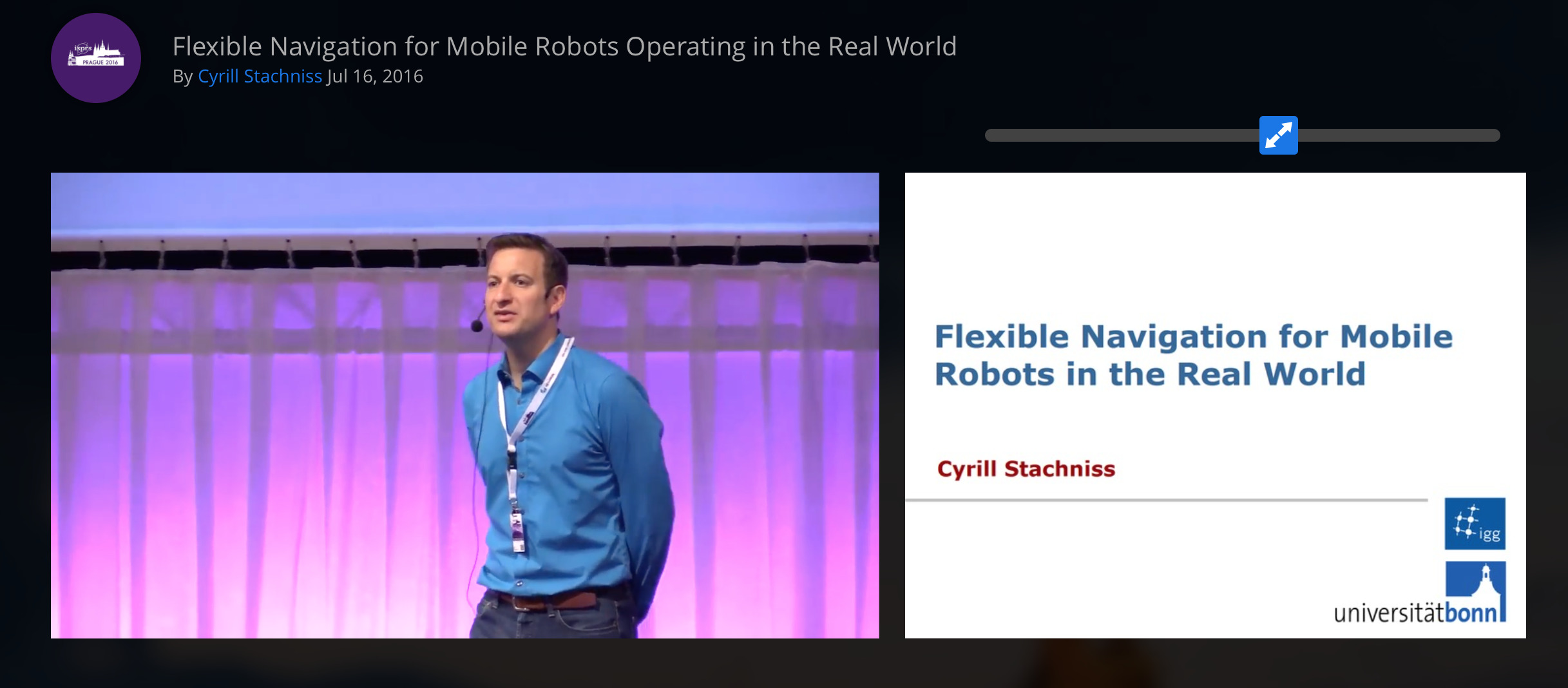
Cyrill Stachniss have a plenary talk at the ISPRS 2016 Congress in Prague on autonomous robots exploring Roman Catacombs and mobile vehicles navigating through urban environments (EC funded projects ROVINA and EUROPA2).
See the ISPRS 2016 Congress Website for details.
Visit our UAV-g 2017 Website!
In September 2017, we are organizing the UAV-g 2017 conference in Bonn. The aim of UAV-g 2017 is to bring together experts in photogrammetry and remote sensing, surveying, robotics, computer vision, artificial intelligence, aerospace engineering, geosciences and various UAV user communities. Researchers, developers, service and systems providers as well as users are invited to contribute with presentations, posters, exhibitions, live demonstrations and discussions to create synergies between research and applications using UAV in Geomatics. UAV-g 2017 will take place in Bonn, Germany on September 4-7, 2017 and is the 4th edition of the International Conference on Unmanned Aerial Vehicles in Geomatics.
Prospective authors are encouraged to submit their paper contributions on the following topics among others: